-
Join 4,168 other subscribers
-
Recent Posts
Recent Comments
Don Osmund on Using an Articulating Hedge Tr… Kirk Garanflo on Using an Articulating Hedge Tr… Don Osmund on Using an Articulating Hedge Tr… A on Using an Articulating Hedge Tr… Radek on Using an Articulating Hedge Tr… Archives
- February 2026
- January 2026
- November 2025
- October 2025
- September 2025
- August 2025
- July 2025
- June 2025
- May 2025
- April 2025
- March 2025
- February 2025
- January 2025
- December 2024
- November 2024
- October 2024
- September 2024
- August 2024
- July 2024
- June 2024
- May 2024
- April 2024
- March 2024
- February 2024
- December 2023
- November 2023
- October 2023
- September 2023
- August 2023
- July 2023
- June 2023
- May 2023
- April 2023
- March 2023
- February 2023
- January 2023
- December 2022
- November 2022
- October 2022
- September 2022
- July 2022
- June 2022
- May 2022
- February 2022
- January 2022
- December 2021
- November 2021
- October 2021
- September 2021
- August 2021
- July 2021
- June 2021
- March 2021
- February 2021
- January 2021
- November 2020
- October 2020
- September 2020
- August 2020
- July 2020
- June 2020
- May 2020
- April 2020
- March 2020
- February 2020
- January 2020
- December 2019
- November 2019
- October 2019
- September 2019
- August 2019
- July 2019
- June 2019
- May 2019
- April 2019
- March 2019
- January 2019
- December 2018
- November 2018
- September 2018
- July 2018
- June 2018
- May 2018
- March 2018
- February 2018
- July 2017
- June 2017
- May 2017
- March 2017
- February 2017
- January 2017
- December 2016
- November 2016
- September 2016
- August 2016
- July 2016
- April 2016
- February 2016
- January 2016
- July 2015
- June 2015
- February 2015
- September 2014
- June 2014
- May 2014
- January 2014
- December 2013
- November 2013
- September 2013
- August 2013
- July 2013
- June 2013
- April 2013
- March 2013
Categories
Meta
Tag Archives: photo monitoring
Prescribed Burn Monitoring – Fire Intensity
Part 1 – Fire Intensity Monitoring Protocol I know, I know. There’s a lot to do during prescribed burn season and monitoring typically isn’t high on the list of pressing priorities. However, I would like to make the case that … Continue reading
The power and limits of photo monitoring
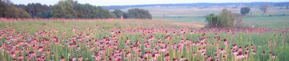
By Bill Kleiman Take a look at this one point on the MRCP Hill Site on four dates. The first photo looks north, then the next photo looks at the ground. What I see in these photos: We did a … Continue reading
Posted in Uncategorized
Tagged Bill Kleiman, oak savanna, oak woods management, photo monitoring, photo points, vegetation monitoring
1 Comment
Photo monitoring results
By Bill Kleiman On the left is the Hill Site owned and managed by the Middle Rock Conservation Partners. On the right is how the left used to look before a brush mower did a lot of work, followed up … Continue reading
Baseline vegetation survey linked to photos
By Bill Kleiman For a recently protected tract I developed a baseline vegetation protocol that seems doable, statistically sound, understandable, and visual. First I created numbered sequential random points. There is a way to get GIS to randomize these points … Continue reading
Posted in Uncategorized
Tagged baseline, Kleiman, photo monitoring, photo point, protocol, savanna, vegetation monitoring
1 Comment
