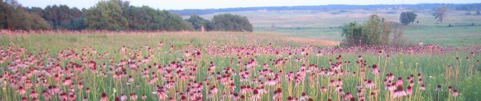
By Bill Kleiman
Arc GIS Field Maps, known previously as Collector, is a powerful phone app. The app is free, but you do need a GIS online program to run it, which typically means you need your employer to support you. On this image you see random round dots of a few colors, each color represents a different invasive weed. There are green diamond shapes which are native plant occurrences, which represent cool plants we want to remember to come back to, perhaps to pick seed. This morning, I noted starry campion for seed picking later.
These dots/waypoints/geo-referenced points….whatever you call them….are really handy. For instance, they help us see the pattern of infestation of weeds where sometimes a strategy can come to mind. Over time we hopefully have fewer weed dots.
Now differently, note the east west line of red dots. Each dot represents at least one birdsfoot trefoil, BFT, Lotus corniculatus. I started on the east end of this field and used my phone compass to aim west and found a district tree to aim for. I took a step, looked down for BFT. If there was a plant, flowering or not, big or small, I dotted it. There was a plant sometime every step, sometime every two steps, but rarely could I go more than 5 steps without a plant within three feet of my boots. This transect took about 45 easy minutes. I tore the plants out that I found as I did not want to carry a sprayer.
Why walk a line instead of recording all occurrences in this field? I don’t have time to record every BFT in this field. That would take a week. The point of monitoring with quadrats, whether on a transect or randomly placed, is to help us understand a field by sampling a small part of it.
I know this field rather well. In the 1980s the farmer planted birdsfoot trefoil in this pasture. The soil became full of BFT seed. Three decades ago I started to boom spray the former pasture. After this decade of boom spraying we erred in deciding to plant prairie in this field. Then we had about two decades of hard labor of back pack spraying BFT, but you can see the BFT is still there. I did this monitoring transect after we had been through the field for eight hours with seven people with packs. So these are the plants we missed. Sigh.
Lesson learned: Do not plant prairie into ground that has invasive weeds.
This method of monitoring with Field Maps is intuitive, visual, easy to understand, and stored automatically with your other data. I don’t need to write a report about these weeds. You can see the pattern as well as I can.

Here I zoom out for a more complete sense of our preserve and its weed occurrences. We spend a lot of time on these spots. How can we get to treating the weeds faster and with less time, but without doing more harm than good? No easy answers, as you know.

Without organizational GIS support, occurrences and locations can simply be uploaded to iNaturalist, which will map those occurrences, can be filtered by species, include photos, and will take other attributes. Projects can be created for sites, and occurrences can be set to private or obscured so that only certain people can see precise locations. When I visit private landowner properties, I log observations of interest (good and bad) into iNaturalist so I can see on a map afterwards where those things were. Simply logging a photo with a species name takes seconds. …also superior to the specialized apps for invasive species reporting, which are completely redundant. I was with someone from TNC logging an occurrence of Japanese knotweed on EDDMaps while getting swarmed by mosquitos–took him a minute and a half on EDDMaps. Took me 20 seconds on iNat.
I also like iNaturalist. Thanks for sharing.
Do you have a refined plan of attack going after invasives? I have been going after them now for 10 years and that is without BTF? Which to mow (sweet clover is the obvious one as I saw the mowing when I picked the Shooting stars over there). Red clover is it’s own problem but we don’t talk about it much. Perhaps you can give a synopsis on one of the network posts on all the invasives. What you don’t bother with and why. Crossbow for this, Garlon 3 for that, Transline for this and why. I have pulled every Queen Anne’s lace for 9 years as it took that long to exhaust the seed base. This year I have pulled maybe 10 but I never want to see it again. This year I was getting over run by Bladder Campion as never went after it before and became sorry. Fence lines and sprayed areas mainly as seems to get squeezed out if quality stuff. My Reed Canary is under control but it still keeps popping up and a stray Phragmities or two each year. Here is my hit list
RCG
Phragmities
Queen Annes lace
Yellow poison Parsnip
Multi Flora Rose
Canada Thistle
Bull Thistle
King Devil
Garlic Mustard
White and Yellow sweet clover
Red Clover
White clover
Giant Ragweed
Curley Dock
Bladder Campion
Mares Tail
Poison Ivy
Cat tails
This is just 100 acres not 50000 so very interested in refined management techniques and where to spend my bullets and why.
This old post has such a list of weeds and herbicides and methods. https://grasslandrestorationnetwork.org/2013/09/12/which-herbicide-for-various-weeds/
Just because there is still a lot of bird’s-foot trefoil, does that mean the planting was a complete failure? I’ve never seen a planting that did not have some sort of weed here or there.
In a small remnant near my home, I am cutting teasel off at ground level once it has bolted or is flowering. I have been removing seed heads from teasel in this area for a few years and have no disillusion that I will ever completely eradicate it. Even if I get 99 percent, what I miss will still produce seed. The teasel will still be able to spread in from other areas. I have not even looked at my numbers to see if I am now cutting and removing less teasel than when I started.
I tried wiping glyphosate foam onto crown vetch. The native plants survived the treatment. However, tall goldenrod appeared in the location seemingly filling the ground that had previously been occupied by the crown vetch. Is it worth killing the crown vetch if it is going to be replaced by tall goldenrod? I have now found the minimum percentage that will kill crown vetch. I plan to try again. However, I still do not know if controlling the crown vetch will be worthwhile.
I’ve seen caterpillars covered in white fuzz with black heads eating the crown vetch. Recently, I saw a large dark colored skipper in the area. When I looked in my butterfly book, I discovered the wild indigo duskywing eats crown vetch along with native legumes. The orange sulfur is known to eat bird’s-foot trefoil which might explain why I see so many of them.
https://www.illinoiswildflowers.info/weeds/plants/bf_trefoil.htm#:~:text=Birdsfoot%20Trefoil%20(Lotus%20corniculatus)&text=Description%3A%20This%20herbaceous%20perennial%20plant,appearance%20and%20have%20long%20petioles.
I think my work is helping the native plants and animals even though I have no hard data to prove it. Knowing you reduced the population of a weed is easy. Showing it helped native plants and animals is much harder. Maybe winning does not always mean completely eradicating an invasive species.