By Bill Kleiman
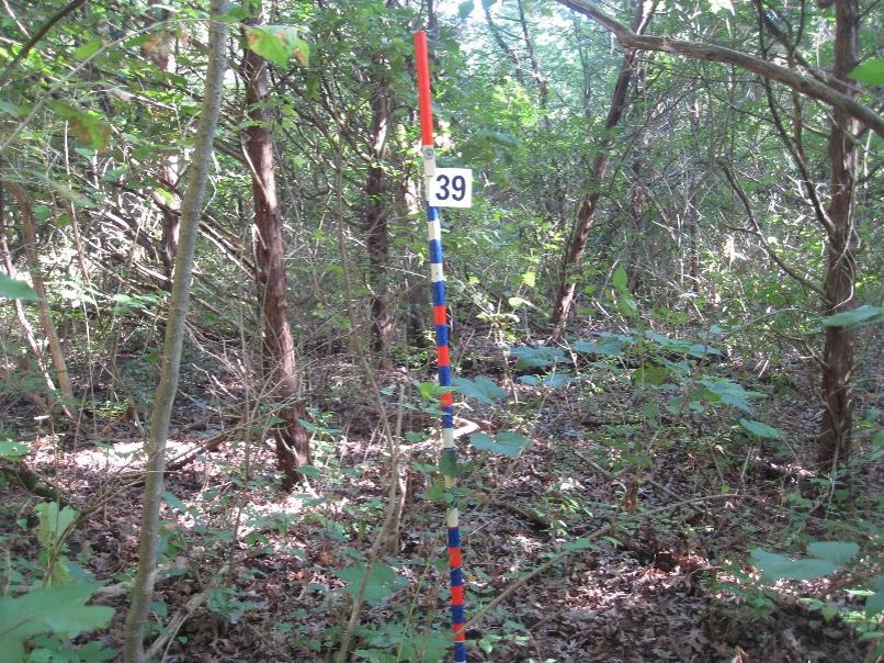
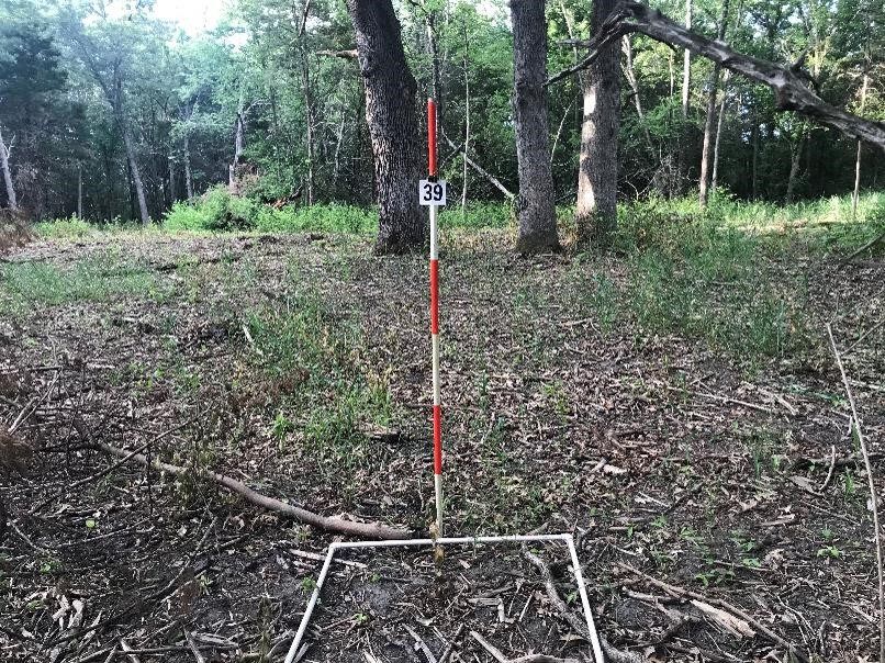
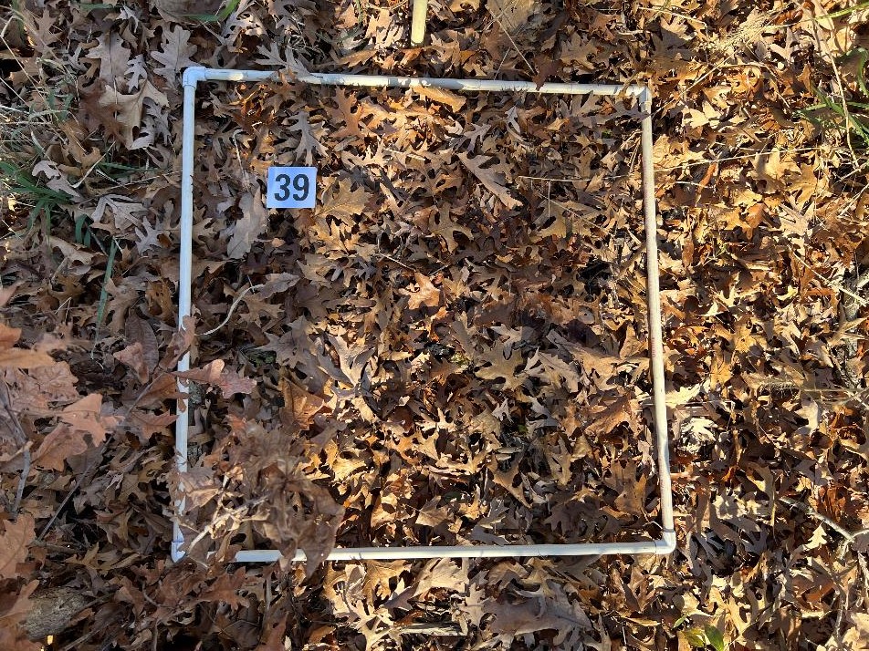
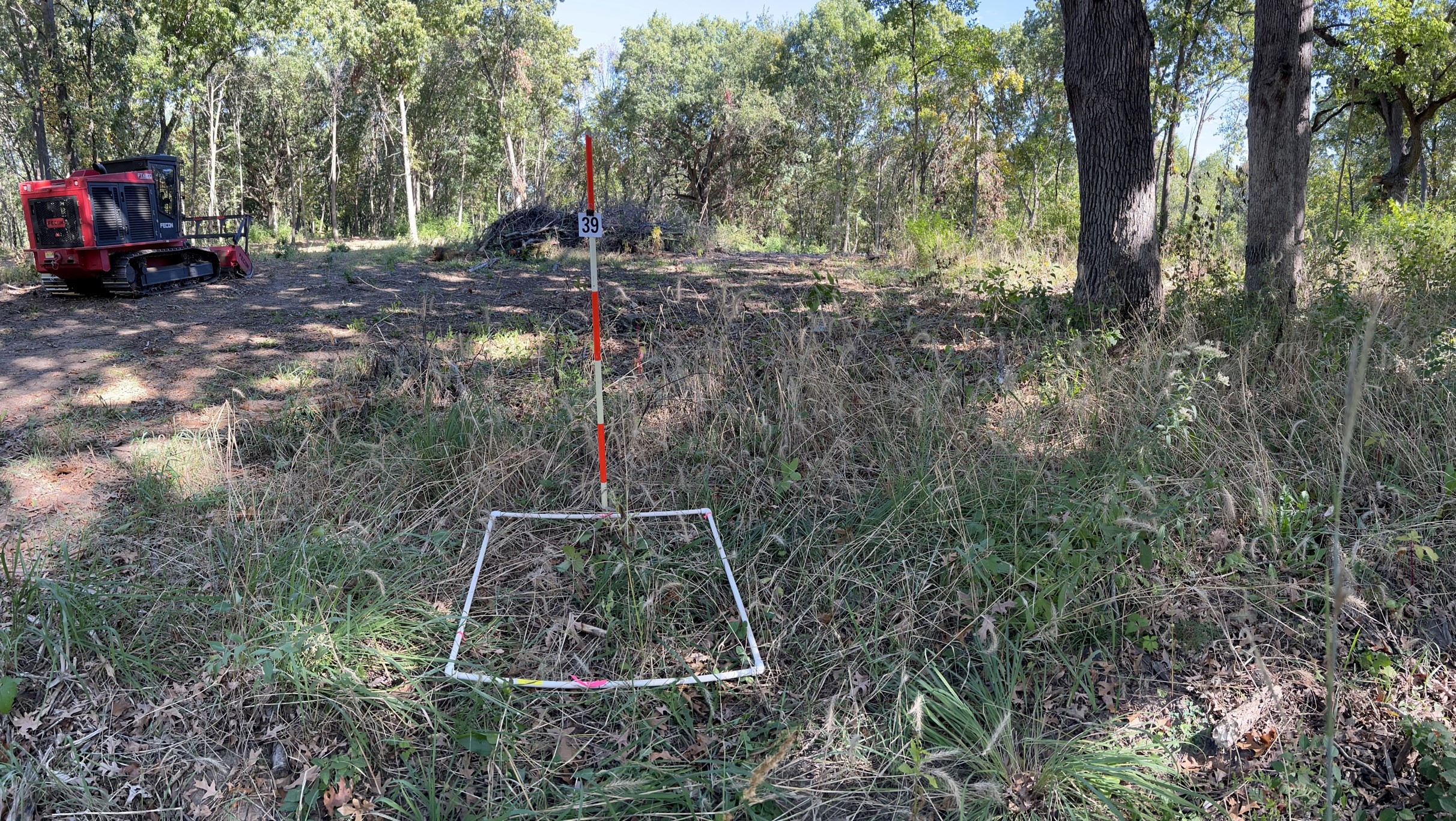
Take a look at this one point on the MRCP Hill Site on four dates. The first photo looks north, then the next photo looks at the ground.


What I see in these photos:
We did a lot of brush thinning that first year so there is a stark difference after year one for the photos looking north. The second photo shows the black after our spring fire, and the slash from the brush mowing. The third and fourth photos seem pretty similar to the second photo. In the third and fourth photo I show a slight panoramic I took with my phone to help place the oak trees in the photo. This gives the viewer a way to anchor the photos.
Unfortunately the brush was originally so thick that you can’t see the oaks in that first image. It might have been better to move the photo point a little closer to the oaks to get them in that first photo, or perhaps clear a bit of brush. Often I will paint a stripe around a tree to help the viewer see it.
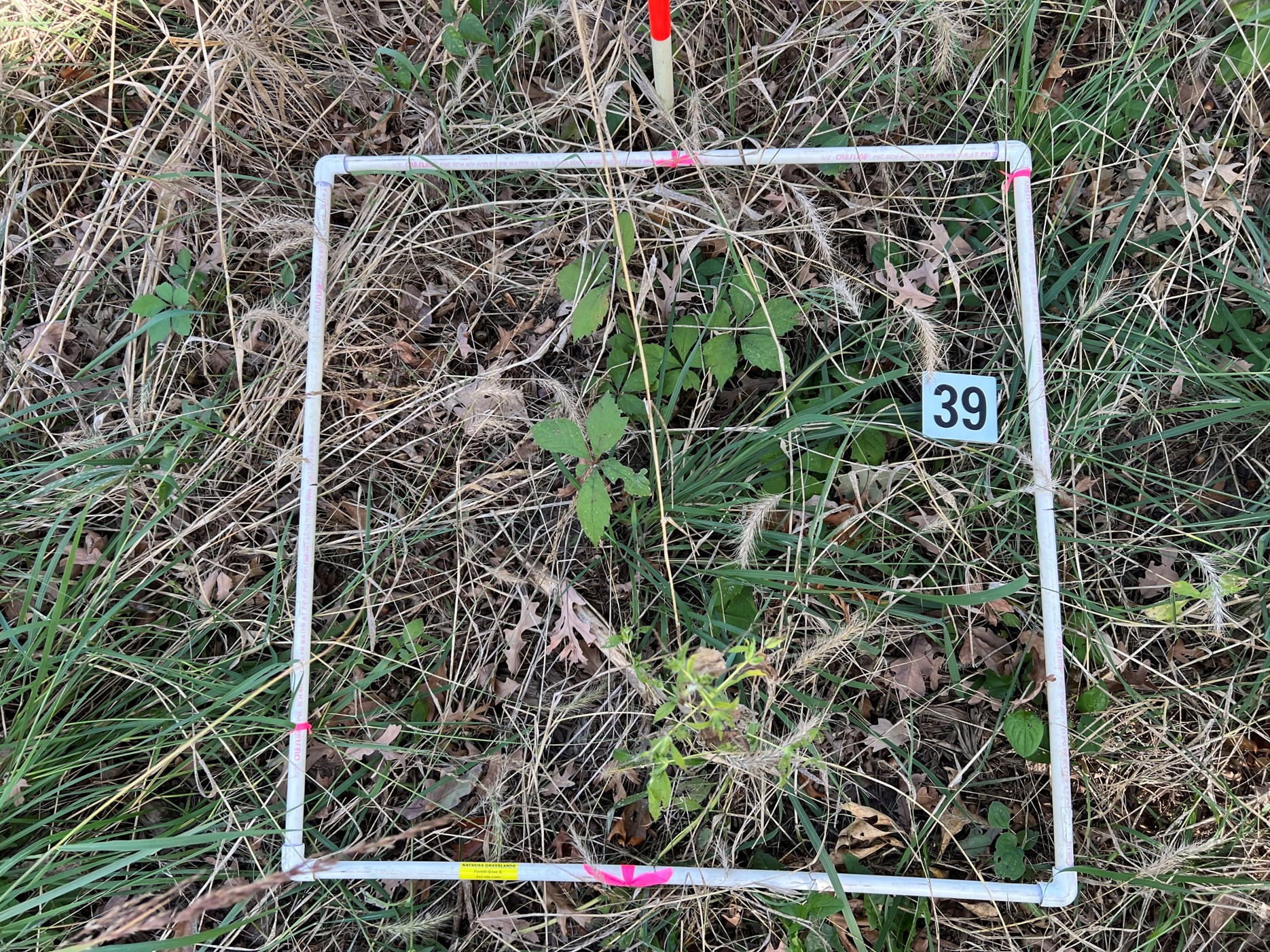
What do you think of the photos looking down? To me, they are less helpful as I can’t make out the species easily from the images. Is the herbaceous layer improving or not?
Why am I doing the photos in different months? Because grant deadlines crept up on us and those were the days we had to take photos.
The cool thing about these photo points is that we also collected the baseline vegetation data before we did any brush clearing. We recorded all species and their percent cover in each quadrat of 50 random quadrats. We will go back next year, which will be year 5, and resample for vegetation and take new photos.
The pairing of vegetation data with photos makes the photos more meaningful and vegetation data more visual.
Here are links to other parts of this data: This is a summary of the baseline veg data with the baseline photos. It describes our protocols too. https://www.middlerockconservationpartners.org/uploads/5/8/4/7/58476113/hill_tract_veg_baseline_survey_summary.pdf
This is the latest set of photos from this site but it does not share the vegetation data: https://www.middlerockconservationpartners.org/uploads/5/8/4/7/58476113/summary_report_mrcp_hill_baseline_photos_after_october_10_2023_optimized.pdf
End. – bk

Pingback: Woodland fire at Hill Site | grassland restoration network